Valleys, ridges, boulders, scratches and long hills — and a file caption that points to an ice age more than two billion years ago.
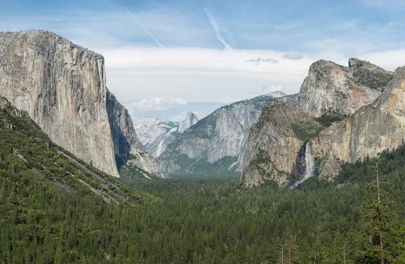
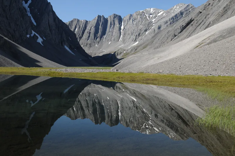
Yosemite Valley from Tunnel View, Yosemite National Park, California, photographed on 16 May 2013 by Diliff. The file description is simply a view of the valley from Tunnel View. The U-shaped trough is the kind of landscape this desk is about; the official ice-age figures live in the articles, not in this caption. Used under CC BY-SA 3.0, on this website only.Photo: Diliff · CC BY-SA 3.0 · Diliff / Wikimedia CommonsA small tarn in a hidden valley in the Itkillik Preserve, Gates of the Arctic National Park and Preserve, photographed on 30 July 2014. The National Park Service caption calls it “sometimes called the Yosemite of the Arctic.” NPS Photo / Cadence Cook.Photo: Cadence Cook, National Park Service · Public domain · NPS / Cadence Cook / Wikimedia Commons
A glacier does not only sit on a map. It carves, carries and dumps. The photographs on this page are credited stills of those marks, with file captions kept as captions.
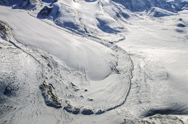
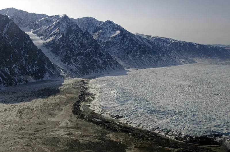
A terminal moraine of a small glacier on Baffin Island, Nunavut, Canada, photographed on 12 April 2013 by Michael Studinger for NASA. The official caption: “Sometimes known as an end moraine, a terminal moraine is an accumulation of soil and rock that shows the farthest point of a glacier's advance.”Photo: NASA / Michael Studinger · Public domain · NASA / Michael Studinger / Wikimedia CommonsThe terminus of Wordie Glacier in northeast Greenland, with a small terminal moraine, photographed on 23 April 2013 by Michael Studinger for NASA. The official caption says Wordie Glacier is a land-terminating glacier that is not in contact with water in the fjord.Photo: NASA / Michael Studinger · Public domain · NASA / Michael Studinger / Wikimedia Commons
NASA’s caption on the Baffin Island still is a definition as well as a picture: a terminal moraine, sometimes known as an end moraine, is an accumulation of soil and rock that shows the farthest point of a glacier’s advance. Wordie Glacier, in northeast Greenland, is a land-terminating glacier with a small terminal moraine, and is not in contact with water in the fjord.
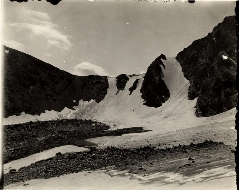
Terminal moraine, Arapaho Glacier, Colorado, 1904, photographed by Junius Henderson. From the Glacier Photograph Collection, National Snow and Ice Data Center / World Data Center for Glaciology, Boulder. The file notes: “May be used freely if properly cited.”Photo: Junius Henderson · Public domain · Junius Henderson / NSIDC / World Data Center for Glaciology / Wikimedia Commons
The same kind of ridge was already being photographed more than a century ago. Junius Henderson’s 1904 print of the terminal moraine of Arapaho Glacier, Colorado, is held by the National Snow and Ice Data Center / World Data Center for Glaciology.
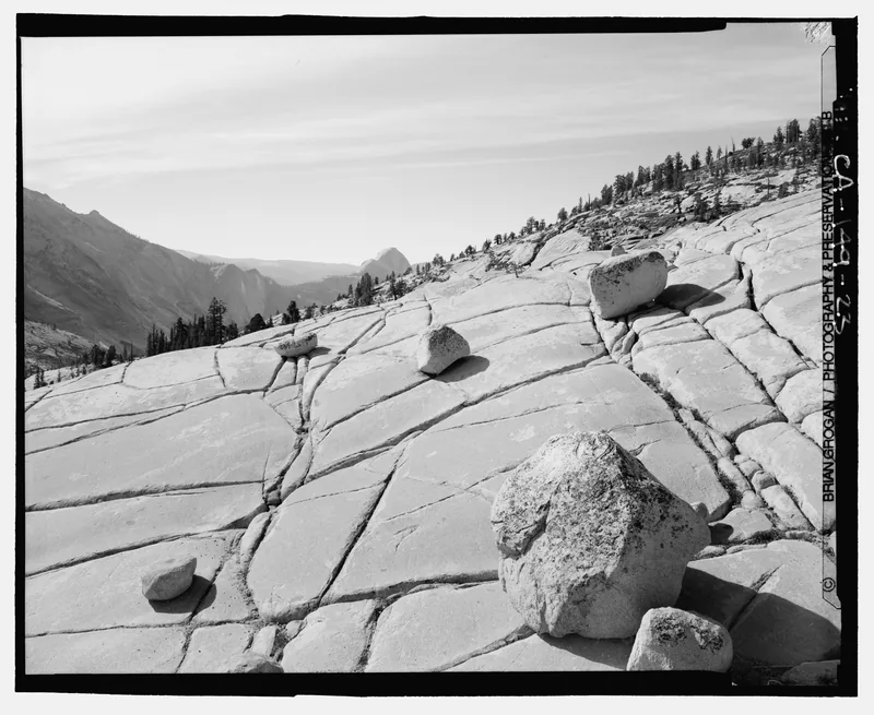
Glacial erratics at Olmsted Point, Yosemite, looking west-south-west, photographed by Brian Grogan for the Historic American Engineering Record in 2001. The file title spells the viewpoint “Olmstead Point.” The usual park spelling is Olmsted Point; both are left as they appear.Photo: Brian Grogan, Historic American Engineering Record · Public domain · HAER / Brian Grogan / Library of Congress / Wikimedia Commons
Erratics are the boulders a glacier carried and put down. Brian Grogan photographed those at Olmsted Point, Yosemite, for the Historic American Engineering Record in 2001. The file title spells the viewpoint “Olmstead Point.” The usual park spelling is Olmsted; both are left as they appear.
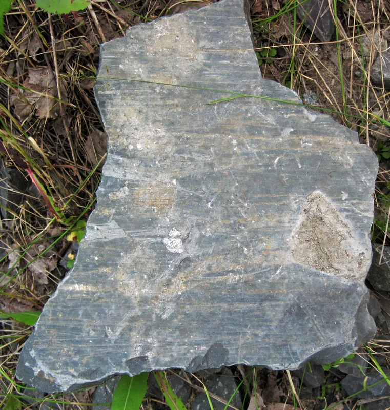
Glacially smoothed and striated tillite in a roadcut north of Temagami, Ontario, photographed on 14 July 2012 by James St. John. The file caption says this is part of the Gowganda Formation, “a ~2.3 billion year old deposit in Ontario, Canada representing a very ancient Ice Age,” later scratched again by Pleistocene ice. That wording is the file caption, not a USGS or NSIDC figure. Used under CC BY 2.0.Photo: James St. John · CC BY 2.0 · James St. John / Wikimedia Commons
Striations are the scratches. James St. John’s photograph near Temagami shows tillite that, on the file caption, is part of the Gowganda Formation, “a ~2.3 billion year old deposit… representing a very ancient Ice Age,” later smoothed and striated again by Pleistocene ice. That deep-time wording is the file’s, and it is one of the oddest sentences on this site.
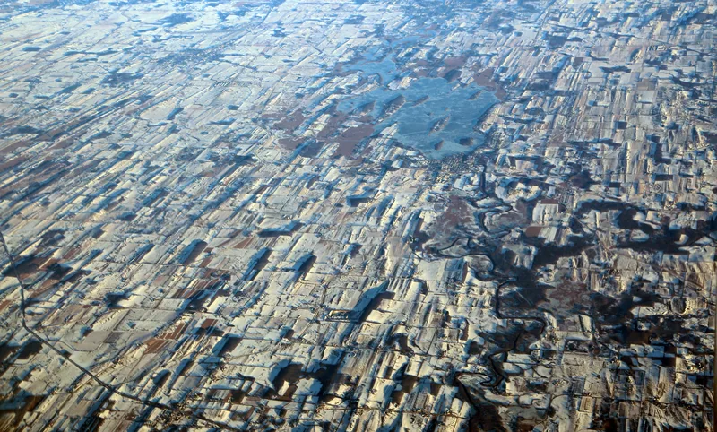
The highly grooved landscape south of Horicon Marsh in Wisconsin, photographed on 29 December 2016 by Doc Searls. The file caption: “The grooves are hills called drumlins, left by the retreating glacier about 12,000 years ago.” That date is the file caption, not a USGS figure. Used under CC BY 2.0.Photo: Doc Searls · CC BY 2.0 · Doc Searls / Wikimedia Commons
Drumlins are the long hills. Doc Searls photographed them south of Horicon Marsh, Wisconsin, in December 2016. The file caption dates them to a glacier retreating “about 12,000 years ago.” Official USGS retreat and Holocene dates live on the last-glacial page; they are not silently attached to this picture.
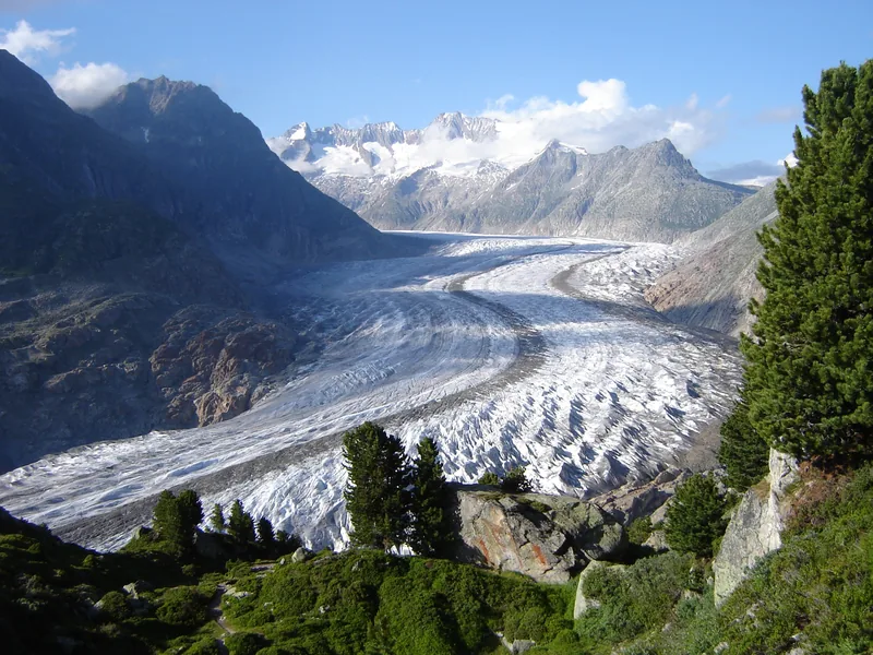
The Aletsch Glacier, with Swiss pines (Pinus cembra) in the foreground, photographed on 22 July 2007 by Jo Simon. Used under CC BY 2.0. A living glacier, and a reminder that ice still sits on the land even when official pages disagree about whether to call the present an ice age.Photo: Jo Simon · CC BY 2.0 · Jo Simon / Wikimedia Commons
And some ice is still here. The Aletsch Glacier, with Swiss pines in the foreground, is a living ice stream in a photograph from 22 July 2007 — a present-day glacier, not a reconstruction of the last glacial maximum.
Keep the lights on
Enjoyed a desk of official ice-age wording, unblended, and the marks glaciers still leave?
No pop-ups. No intrusive advertising. Just interesting stuff. A little support helps the next climates.im site get built.